
Backpacking to East Fork Foss - Necklace Valley and Tank Lakes: A Complete Guide

The classic view of Tank Lakes with Summit Chief, Middle Chief and Little Chief in the background.
Length:
23 miles roundtrip
Elevation Gain:
4100 feet
Area:
Alpine Lakes Wilderness
Difficulty:
Hard
Pass:
NW Forest Pass
America the Beautiful
Dog Friendly:
Yes, on leash.
Tank Lakes via the East Fork Foss - Necklace Valley Trail is a stunning backcountry adventure located in Washington’s Alpine Lake Wilderness. This 23 mile hike takes you through some of the most classic and breathtaking views in the Cascades. The first 4 miles winds through old-growth trees along the East Fork Foss River. After the 4 mile mark, you enter Necklace Valley and begin to climb (or scramble) up to Jade Lake and eventually reaching Tank Lakes where you will be rewarded with panoramic views of jagged peaks, deep valleys, and endless alpine beauty.
I’ve always wanted to do this hike but since the hike itself is 23 miles, I opted to find a hiking buddy for this trip and I looked no further than my buddy Ryan, who I’ve gone for a couple of backpacking trips with. In addition, I started making it a tradition to go backpacking for my birthday every year.
In the past, I probably would’ve opted for spending a night out in the city at a bar or with friends but as I grow older, all I want to do for my birthday is to be surrounded by nature.
We decided to head out to the East Fork Foss - Necklace Valley trail up to Tank Lakes for a 3 day/2 night backpacking trip.
In this blog post, I will provide trail description and good camping spots on the way. I will not only share the logistics of this hike but also what makes it so special.
Start here:
Hiking the East Foss River - Necklace Valley Trail:
The first 5 miles to Necklace Valley
A steep 2 miles to Jade Lake
The final mile to camp: Emerald Lake
Hiking up to Tank Lakes
Exploring Tank Lakes

Ryan at the trailhead of Necklace Valley.
Overview
Tank Lakes is situated in the Alpine Lakes Wilderness. To get to Tank Lakes, you first embark on the 18 mile long East Fork Foss trail and enter Necklace Valley and this is when you can access La Bohn Gap and the Tank/Foehn Lakes area. The trail becomes rugged and at times, unmaintained at this point. This trip can be done in 2-3 days and I highly recommend taking your time to explore this beautiful area.
Permits are self-issuing at the trailhead, which is common in the Alpine Lakes Wilderness with the exception of the Enchantments. By getting a permit, the U.S. Forest Service will know whether this trail is considered high usage or not and it helps them prioritize trail maintenance work. Obviously, it can be important too when something does happen. Search and Rescue (SAR) should also be able to use this information to help locate you.
Dogs are allowed on this trail as long as they’re on leash.
Getting to the trailhead
Coordinates: 47.6659, -121.2881
The East Foss River - Necklace Valley trail is located in the Alpine Lakes Wilderness but also in the Central Cascades - Stevens Pass area. I used the coordinates provided on Washington Trails Association (WTA) and it was spot on. It is located about 2 hours away from Seattle. Highway 2 can get messy on a fine summer day so a little patience goes a long way. However, there is plenty to see on the way.
The parking lot was medium-sized and could fit probably about 15-20 cars if everyone parked properly. There was also a bathroom at the trailhead and a picnic table.
Hiking the East Foss River - Necklace Valley Trail
The first 5 miles to Necklace Valley


It is a relatively long hike to get to Necklace Valley. The good news is, the first 5 miles gain only about 600 feet. You will be hiking along the East Foss River the entire way. This section of the trail was logged by the railroads in the early 1930s. About 4ish miles in, there is a boot path that brings you closer to the river. The first 5 miles also take you through old-growth forests. In the summertime, I’m sure you can find an abundant of various species of wildflowers. I did this trail in mid-September so it was well over wildflower season.
In this section of the trail, you will find established campsites and a privy. You will also find remnants of the railroads and logging equipment that was once used in this area.
I already knew the climb into Necklace Valley would be grueling so Ryan and I decided to take a long break here. For day hikers, this might be a good turnaround point. If you do decide to push forward to the first of the lakes - Jade Lakes, I highly taking a breather here and mentally prepare yourself for the long hike ahead.
A steep 2 miles to Jade Lake

View of Necklace Valley.

Jade Lake.
This part of the section was no joke in terms of elevation gain. What made it more difficult was the trail was clearly more rugged in this section. Large boulders and tree roots dominate the trail. With a big pack on, I really took my time hiking this section. You gain 2400 feet in just 3 miles until you reach Jade Lake. I thought I was in shape, especially my summer consisted of harder training hikes like Mount Si and Mailbox Peak. Plus, I also attempted to summit Mount Baker in July. I thought this section would be easy but it clearly wasn’t.
I would say, when you emerge from the flat section and head towards the boulders before it meets the official trail again, this section can get a little bit tricky. It took Ryan and I some time to figure out the best way to overcome the large boulders before reconnecting with the maintained trail. Take your time here. However, there were hardly any places to rest until you hike for an additional 1.5 miles. Here, you will find another established campsite. This would be a good place to pitch your tent if you absolutely felt defeated after climbing steeply and steadily.
I do recommend pushing through to camp at Jade Lake. Jade Lake is the first gem you will come across once you enter Necklace Valley. Again, there are established campsites here. Jade Lake was peaceful and quiet when we did this hike. There were only 2 groups camping here when we finally arrived. I believe most of the campsites give you a splendid view of the lake and easy access to a reliable water source.
The final mile to camp - Emerald Lake

Emerald Lake.

Camp for the night at Emerald Lake.
We pushed forward and went beyond Jade Lake in hopes to camp at Emerald Lake. This last mile to camp eased out in terms of elevation gain significantly. I felt so relieved because the last 2 miles of nonstop climbing over tree roots and boulder really dampened my mood and I felt like I had so little left in me to push forward. Ryan did power hike to check out Lake Illswoot - which was another lake located I think about 0.5 miles from Emerald Lake. I was so beat that I stayed behind at Emerald Lake to secure the spot in case Lakes Illswoot was a no-go.
Emerald Lake wasn’t as spectacular as Jade Lake but the campsites here were a little more open. We found a great spot with easy access to a reliable water source - there was a small stream on the north end of the lake. Ryan and I were both happy to finally set our packs down and set up our tents for the night. The clouds cleared up a little bit when we got here and I was able to see blue skies for a little bit. The weather was still a little iffy and we weren’t sure what our plan would be for the next day. However, even if we opted to not hike up to Tank Lakes, there turned out to be plenty to explore in the area here.
Hiking up to Tank Lakes
I slept super well, probably because I was exhausted from all the hiking the previous day. When we woke up, the weather was looking pretty promising. It was mostly cloudy but we could tell that the sun was fighting through the clouds. We had a pretty slow morning and enjoyed some coffee and breakfast. We then decided that we should take the chance to head up to Tank Lakes.
As mentioned, there was plenty to explore even before getting up the final boot path to Tank Lakes. We sidetracked a little and decided to visit Cloudy Lake. On the way, we also saw Opal Lake although Opal Lake was more like a boggy lake than an actual lake. There was no official trail to Cloudy Lake but there was a faint boot path, meaning someone else probably had the same idea to visit these less known lakes. We spent a good hour here. I took some photos and decided that it was time to finally venture up to Tank Lakes.
At some point, we did contemplate hiking up to La Bohn Gap instead. However, from afar, the trail looked a little too challenging so we stuck with the original plan to get up to Tank Lakes. The trail from Emerald Lake to the intersection for La Bohn Gap and Tank Lakes was well marked. From here, it was almost a ‘choose your own adventure’ situation. You could either follow the boulder field all the way up to Tank Lakes or I think you could eventually take a diverted trail that required less scrambling over boulders. I think we took the latter back down to camp due to the boulders being a little slick.
Nothing was too technical here although part of this trail became steep at times while hiking on scree. However, it was still nothing compared to hiking the last 3 miles up to camp from yesterady.

Exploring Cloudy Lake and Opal Lake.

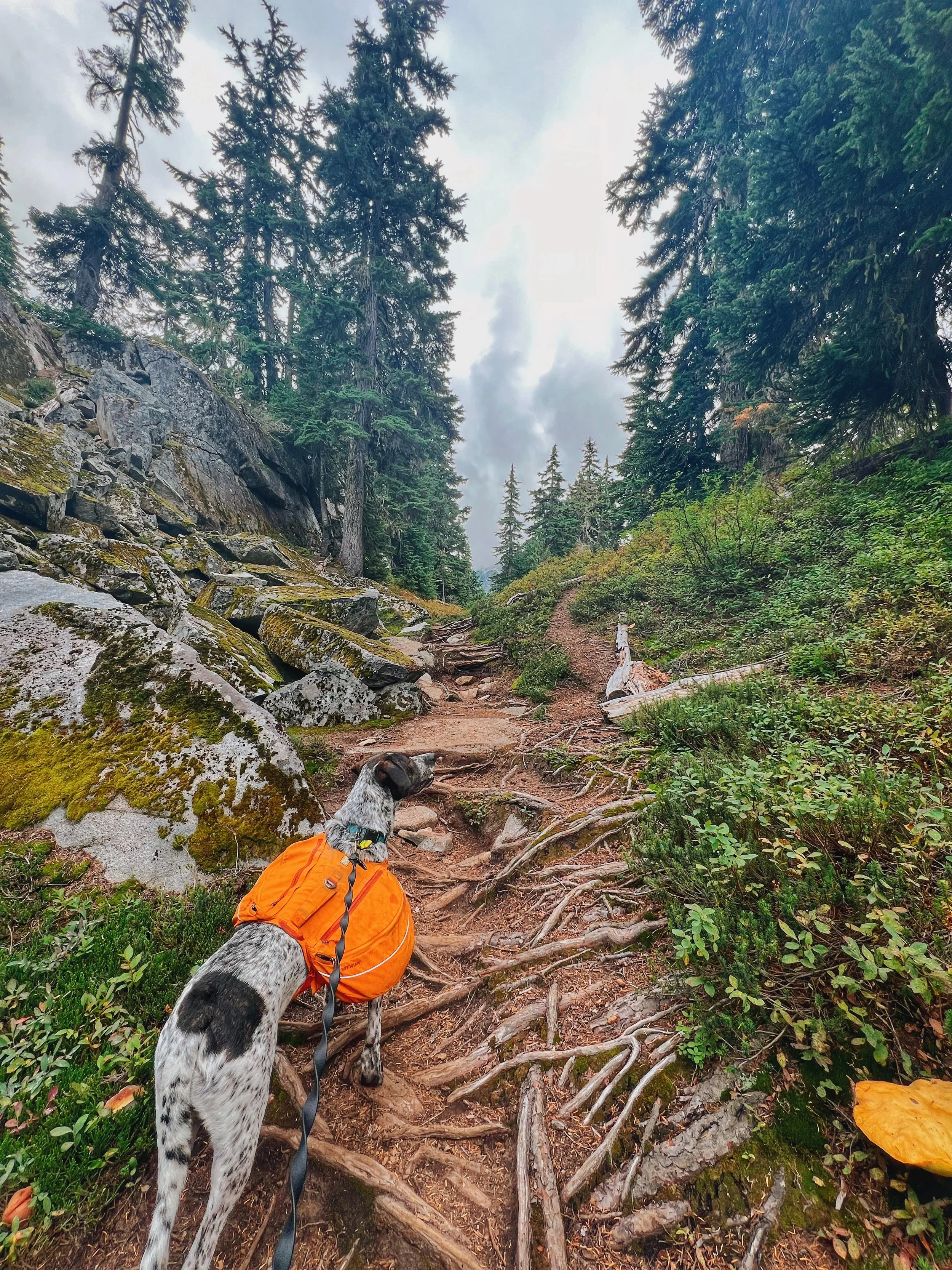
Tex on the boulders on the way to Tank Lakes.
Exploring Tank Lakes

After hiking for about an hour or maybe a little more, we finally made it to Tank Lakes. Tank Lakes really was a series of smaller lakes that made up the area. However, it wasn’t hard to miss the classic view of overlooking the first lake against Chief Summit. You basically see it right when you started hiking around the first lake.
I was so happy to finally find myself at Tank Lakes. This hike has been on my list for a while and since I don’t often visit the Alpine Lakes Wilderness, I felt like this was an accomplishment especially because we hiked a good amount of miles before we got here.

The weather was in our favor. Although the skies were still somewhat cloudy, we didn’t get rain and we even got some sunshine. We found a spot to enjoy some snacks and lunch and spent some time exploring the various ‘little hills’ that made up this area. It was easy to hop from one hill to another hill even though there weren’t official trails. I saw a few campsites and could imagine that on a busy summer day, a lot of these would be filled up. There were spots with a little more privacy if you are willing to hike a little extra to camp by the trees. If not, most of the area can feel a little exposed especially if there were high winds.
After spending a couple of hours exploring Tank Lakes, we decided to head back down to camp. This was when the storm clouds started to roll in and began drizzling. No complaints though because were at least able to explore this area without any rain. We did take a slightly different path to head back to camp. This part of the trail was clearly unmaintained and there were a good amount of downed trees. At some point, we thought we were lost but after studying the map for a little bit, we were able to reconnect with the main trail that brought us back to camp.


Final Thoughts


The hike out was brutal. It rained a lot on Saturday night so the roots and rocks became slippery. We were extremely slow on the first 3 miles of descent so we took a very long break at the same campsite along the river after the steep descent. The rest of the hike out was uneventful. There were tons of mushrooms to look at though!
I was very happy to finally be able to do this hike and I definitely want to come back to this area to camp at Tank Lakes and even try to complete this hike as a loop to the West Foss trailhead. But that's for next year!
Reaching Tank Lakes is an unforgettable reward for those willing to take on the challenge. With its breathtaking alpine scenery, peaceful solitude, and stunning panoramic views, it’s a true gem of the Alpine Lakes Wilderness. This adventure is one you won’t soon forget. If you’re up for the challenge, Tank Lakes is a bucket-list-worthy destination that captures the wild beauty of the Pacific Northwest.
Resources
🌲 Wilderness Regulations - USFS resource on wilderness regulations
🌲 East Fork Foss - Necklace Valley on WTA - Trail description, passes and directions
🌲 My recording on GaiaGPS - I did two recordings, this one is specifically for hiking up to Tank Lakes