
High Rock Lookout
Not gonna lie, I am actually quite a sucker for low effort hikes but yield big views. While I enjoy hiking and backpacking, there are times when I just want to get on an easy and familiar trail and that’s especially applicable when doing a solo sunset hike. If you are just like me then this is the trail for you because the hike to High Rock is only 3.2 miles roundtrip and a gentle elevation gain of 1365 feet (these stats are from the Washington Trails Association (WTA) trail page). Without further ado, let’s get into it.
Distance:
3.2 miles rountrip
Elevation Gain:
1236 feet
Area:
South Cascades
Gifford Pinchot National Forest
Pass:
America the Beautiful
Northwest Forest Pass
Overview

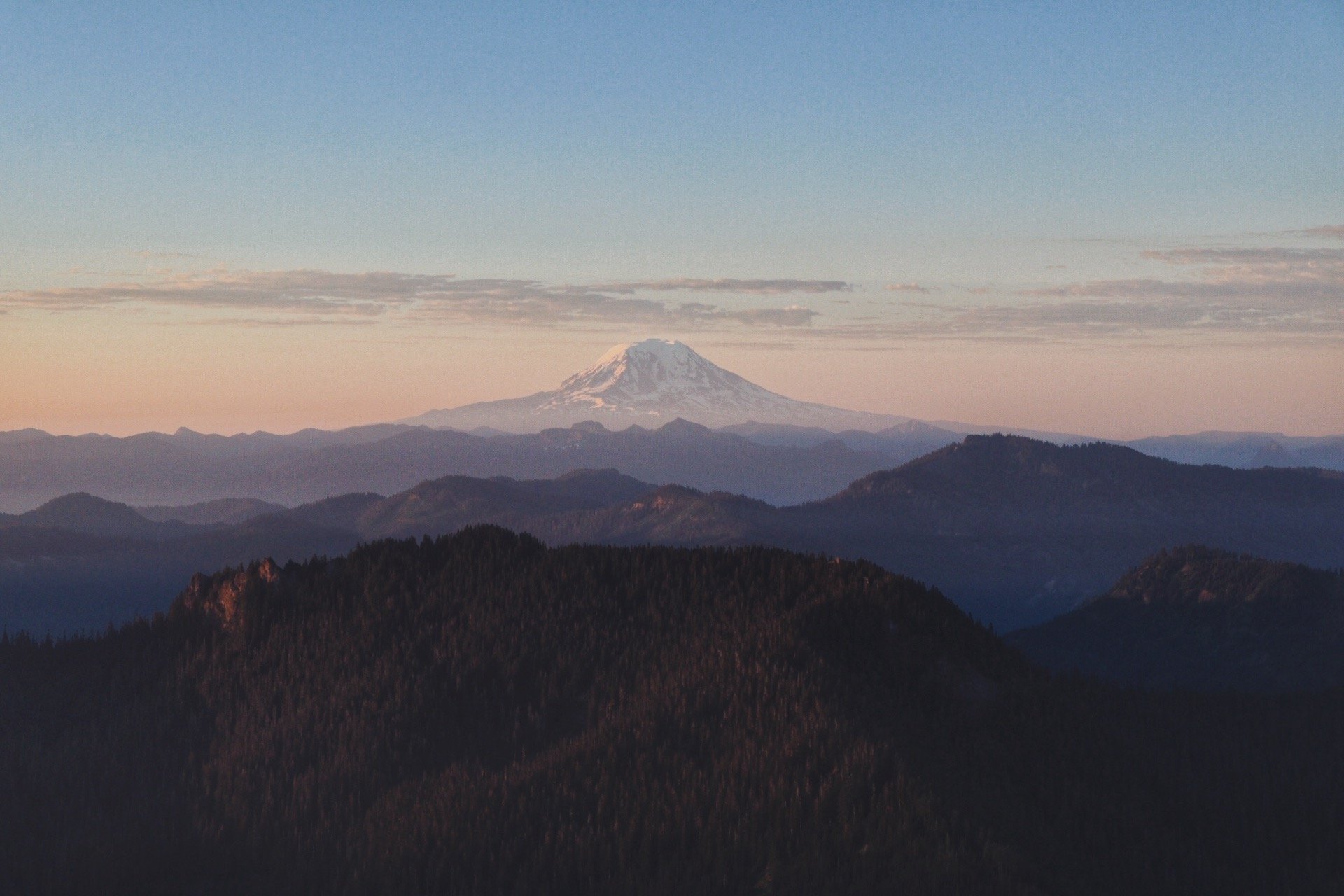
A hiker on the ‘slab’ right below the platform to the right overlooking Mount Adams (Pahto).
High Rock Lookout is located near Ashford, WA in the Gifford Pinchot National Forest. The road to turn to the forest service road for the trailhead actually takes you all the way into the Paradise area of Mount Rainier National Park but don’t quite go too far, the turnoff to Skate Creek Road is actually only 8 miles away from the official national park entrance.
Skate Creek Road is generally closed in the winter time. The road is your typical forest service road but definitely not too bad. The first few miles is on a paved surface with occasional potholes. The last few miles turn into gravel. Take it slow and your low clearance vehicle should make it with no problem.
As of summer of 2021, the lookout actually does not exist as it was in dire need of repairs and restoration. You will see a platform when you get to the top. I’m not entirely sure when the new lookout is going to be built but I kind of like it when it’s just the platform as more people can fit on it and share the space. Although with my nervous dog, I generally stay in a spot right below where the lookout used to be.
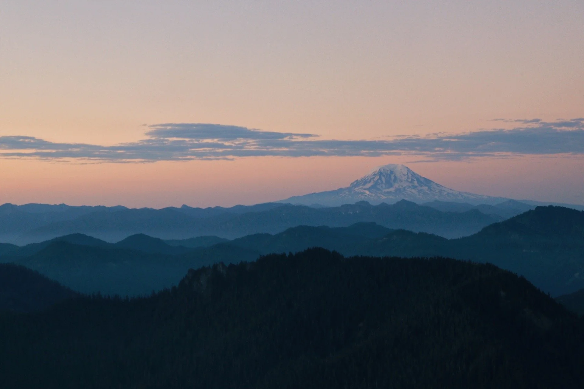
I’ve done this hike during sunrise and sunset. I personally enjoyed sunrise more even though I am not a sunrise person at all. I will have photos comparing what sunrise and sunset looks like so read on!
Getting to the trailhead
Trailhead coordinates: 46.6664, -121.8914
If you’re not the type of person that downloads offline maps on your phone then I recommended just downloading the instructions through WTA. But I do highly suggest downloading an offline map for anywhere that is a little more remote or when you might not get cell service since it significantly lowers your chances of getting lost.
The parking area isn’t big but fits a good amount of cars. I’ve always gotten there at a decent time like way before sunrise or way before sunset to give myself enough time to hike up to the platform. Not really sure how this trail would look like on a weekend but I imagine cars would start to line up along the dirt road leading up to the parking area. Remember to not block anyone and the road.
The hike
I personally enjoyed hiking High Rock for sunrise more than sunset. I enjoyed the fact that I was able to hike back down to the car in daylight as opposed to hiking back to the trailhead in the dark. I definitely had a little more motivation the first time I hiked it because 1) I’ve never done the hike and 2) the thought of watching the sun rise was extremely exciting. Nonetheless, if you have the time and energy, I recommend trying the hike for both sunrise and sunset.
Hiking up for Sunrise

Making it before the sun is due to rise. I recommend getting to where you need to be 30-45 mins before to secure a spot!
As mentioned, the hike itself wasn’t hard. It was constant uphill until the lookout and another questionable ‘scramble’ on slab until you reach the platform, where the lookout once stood. But I would recommend this hike to anyone - I’ve hiked a lot of the trail in the dark and it’s never been a problem. The trail is very well-maintained with the occasional roots popping out the ground. Otherwise, watch your step and take plenty of water with you as this trail does get hot as part of it was exposed and there was nowhere to fill up on the way up and at the top.
I’ve done this hike both times in July so the sun rose early and set late. The first time I hiked it was during sunrise. I didn’t know what to expect but all I knew was I wanted to see an epic sunrise. I got to the platform (I didn’t actually hike all the way up to the platform because of my dog) at about 4:45am. The way up took me about 1.5 hours with some breaks and also passing some folks that were also on the way to see sunrise. I secured a spot a little away from the crowds and on the ridge line that gave me unobstructed views of Mount St. Helens and Mount Adams. To get a good view of Rainier, you would either stay to the left or get up onto the platform. I opted for a less crowded spot, made a coffee and waited patiently for the sun to pop out.


Sunset hike up to High Rock

Don’t get me wrong, I still very much enjoyed the sunset hike up to High Rock. I was more well-rested.
When I did High Rock for sunrise, I tried to sleep in my car for the first time. I was climbing prior so I didn’t get to the trailhead until about midnight. Driving on the dirt road wasn’t too fun but I obviously made it up. By the time I found a spot to park, I was exhausted. I should’ve known though that everyone and their moms would want to hike up to the lookout on a Saturday morning. Although I didn’t have to worry about securing a parking spot, I barely got any sleep. I think I slept for about 2 hours or less. When the clock struck 3:30am, I decided that it was time to get the hike started.
It was also actually significantly less crowded hiking it during sunset - at least while I was on the trail. I wasn’t sure why but the second time I did this hike felt harder and I didn’t realize how much uphill I was gaining until I did it the second time. But I actually completed this hike in less time than the first time (yay me!).
I didn’t take nearly as many pictures the second time I was up on the platform because the sun somehow felt like it was setting a lot faster than I expected but I also sat in silence while for the ‘almost’ last night disappeared into the horizon.


Final thoughts
This trail can get extremely popular on sunny days but I highly recommend beating the crowds by opting to do a sunrise or a sunset hike. Hiking during sunrise can also be busy but I imagine it will be a little less crowded compared to going during the day. This was the first (and only so far) sunrise hike I’ve done so far - I picked this trail because I knew it was going to relatively easy and its short distance was rather reassuring especially when I was hiking in the dark for 50% of the time. Having a dog definitely helped eased some of my anxieties but the reward up top was so worth it.

Resources:
🌲 Wilderness Regulations - USFS resource on wilderness regulations
🌲 Official USFS page of the High Rock Lookout trail - check to see current conditions
🌲 The 7 Leave No Trace Principles - always good to brush up on this before heading out
🌲 Trail Description on Washington Trails Association (WTA)
🌲 History of High Rock Lookout